There are several different ways to look at old maps for our village (and if you want a book with some of these in, see here):-
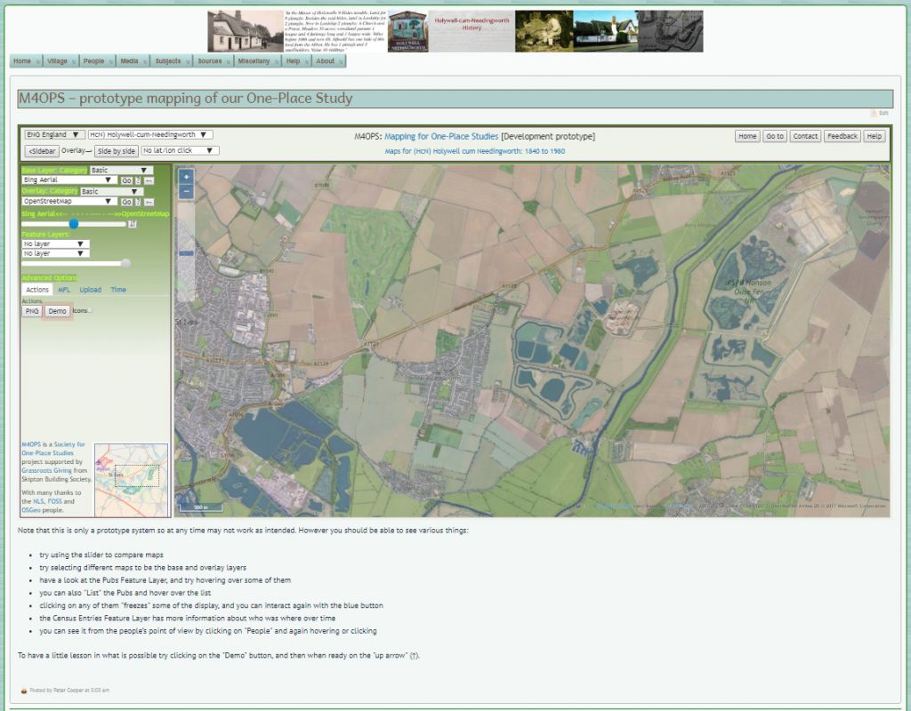
Using modern technologies, I have developed a way of showing maps for a One-Place Study, and you can see lots of old maps for our village in the prototype system (M4OPS – Mapping for One-Place Studies).

If you want to see the six-inch maps from around 1900 superimposed on modern maps using the NLS site then click here (use the slider to change the balance).

Although NLS (the National Library of Scotland) have a full collection of Scottish maps, surprisingly they do have several years of (out of copyright) Ordnance Survey 25-inch, six-inch and one-inch maps covering England. If you want to explore the full NLS collection click on the NLS icon or here. With thanks to the Ordnance Survey and the National Library of Scotland.
The other old maps are photos of old small scale maps, most of which were taken at Huntingdon Library.
Using the NSG image gallery/ies below
| Description | Images |
|---|---|
| Lynam's SW portion of a map of the Fenland [1604] [D01342] | |
| Saxton's Map of Huntingdonshire [1610] [D01345] | |
| Jansson's Map of Huntingdonshire [1641] [D01351] | |
| Blaeu's Regienes lnundatae [1645] [D01355] | |
| Jansson's Comiatus Cantabrigiensis [1646] [D01356] | |
| Speed's Map of Huntingdonshire with towns of Huntingdon & Ely [1662] [D01359] | |
| Morden's Map of Huntingdonshire [1695] [D01363] | |
| Ogilby's Road from Huntingdon to Ipswich [1698] [D01364] | |
| Blome's Map of Huntingdonshire [1716] [D01367] | |
| Harris's Great Level of the Fens [1720] [D01368] | |
| Moll's Map of Huntingdonshire [1724] [D01372] | |
| Badeslade's Map of Huntingdonshire [1742] [D01375] | |
| Kitchin's Map of Huntingdonshire [1748] [D01378] | |
| Palmer's Map of Huntingdonshire [1750] [D01380] | |
| Gordon & Bowen's Map of Huntingdonshire [1760] [D01384] | |
| Cary's Map of Huntingdonshire [1787] [D01395] | |
| Harrison's Map of Huntingdonshire [1788] [D01397] | |
| Cary's Map of Huntingdonshire [1792] [D01400] | |
| Cary's Map of Huntingdonshire [1801] [D01403] | |
| Jones & Smith's Map of Huntingdonshire [1801] [D01404] | |
| Butters's Map of Huntingdonshire [1803] [D01405] | |
| Cole's Map of Huntingdonshire [1806] [D01407] | |
| Laurie & Whittle's Map of Huntingdonshire [1806] [D01409] | |
| Wilkes's Map of Huntingdonshire [1806] [D01410] | |
| Cooper's Map of Huntingdonshire [1808] [D01411] | |
| Cooke's Map of Huntingdonshire [1812] [D01416] | |
| Neele's Map of Huntingdonshire [1815] [D01418] | |
| Langley's Map of Huntingdonshire with St Ives Church [1818] [D01420] | |
| Smith's Geological Map of Huntingdonshire [1821] [D01424] | |
| Gardner's Map of Huntingdonshire [1822] [D01425] | |
| Pigot & Slater's Map of Huntingdonshire [1823] [D01427] | |
| Rowe's Map of Huntingdonshire [1829] [D01430] | |
| Huntingdonshire parliamentary map [1831] [D01439] | |
| Pigot's Map of Huntingdonshire [1831] [D01440] | |
| Duncan's Map of Huntingdonshire- arrangements effected by Reform Bill [1833] [D01443] | |
| Creighton's Map of Huntingdonshire [1840] [D01455] | |
| Fullarton's Map of Huntingdonshire [1840] [D01456] | |
| Archer's Map of Huntingdonshire [1842] [D01457] | |
| Walker's Map of Huntingdonshire [1843] [D01460] | |
| Hall's Map of Huntingdonshire - shows railways [1860] [D01469] | |
| Hughes's Map of Huntingdonshire- shows railways [1860] [D01470] | |
| Dower's Map of Huntingdonshire [1863] [D01471] | |
| Cruchley's Railway and station Map of Huntingdonshire [1864] [D01472] | |
| Weller's Map of Huntingdonshire [1864] [D01473] | |
| Weller's Map of Cambridgeshire and Huntingdonshire [1870] [D01476] | |
| Cruchley's Map of Huntingdonshire [1878] [D01477] | |
| Slater's Map of Huntingdonshire [1846] [D01639] | |
| Greenwood's Map of Huntingdonshire with view of Kimbolton castle [1829] [D01667] | |
| Archer's Map of Huntingdonshire [1842] [D01677] | |
| Ordnance Survey's OS Sheet 187 1 inch to the mile [1892] [D01681] | |
| Map of Huntingdonshire showing the New Divisions of the County [1885] [D01682] | |
| Creighton's Map of Huntingdonshire [1832] [D01683] | |
| Universal Magazine's Map of Huntingdonshire [1750] [D01691] | |
| Kelly's Directories's Map of Huntingdonshire [1936] [D01702] | |
| Samuel Wells's Great Level of the Fens - Bedford Level [1829] [D01706] | |
| OS's 1" to 1 mile Old Series No 51 St Ives, Cambs, Suffolk [1914] [D01756] |
Leave A Comment